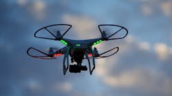
After being assembled and calibrated by a group of engineers, the quadcopter lifted itself in the air, hovering with its whirring propellers, and flashing a light bulb at the long-exposure cameras standing in a large, open warehouse. Through the use of stop-motion animation, the aerial drone appeared to trace cubes, ellipses, waves, and messages with these points of light. It was all part of a recent promotional video released by PreNav, an unmanned aerial vehicle (UAV) company based in San Carlos, Calif. The company has built a new UAV system that can make the exacting movements necessary to inspect industrial equipment and tall structures, such as wind turbines and cell towers.
The heart of the patent-pending navigation system is a tripod-mounted ground station, which controls the quadcopter’s flight path around the structure or interior space. This “guidance robot” scans the structure with lasers and generates a three-dimensional point cloud, from which it develops a flight path for the aerial drone. Once the flight begins, it sends position updates to the drone, controlling its flight around the structure, and keeping it stable against wind and other disturbances. The UAV is apparently capable of flying within centimeters of a structure, according to the company.
Unlike most other UAV navigation systems, the PreNav drone does not rely on GPS data. Many autonomous drones use GPS to navigate pre-set flight paths, but the information is not accurate enough to fly close to sensitive or dangerous equipment. “The current generation of drones struggle when they need to fly close to structures, due to the limitations of GPS and collision-avoidance sensors,” says Nathan Schuett, the CEO of PreNav and former machine-vision engineer at The Society for Creative Research.
In flight, the PreNav quadcopter not only takes images of a structure but also reconstructs it into a 3D model, which can then be distributed to technicians on the ground. According to Schuett, the system can fly close enough to identify nuts, bolts, serial numbers, cabling, damages, and other details that would normally only be visible to technicians. In the case of wind turbines and cell towers, technicians usually have to scale these tall structures to inspect for damages and perform maintenance.
The unique perspective of UAVs and the evolution of image sensors has motivated companies to explore their potential for commercial applications. A large number of drone companies, including the consumer-focused Parrot Drone, are developing systems that can be used for agricultural mapping, infrastructure inspection, and security. Sony Corp., for instance, recently released a prototype of an enterprise UAV that processes information over the cloud. Skycatch, a San Francisco-based company, was founded on the idea of using aerial drones to gather data for construction and mining operations.
Although the system will not be available until 2016, PreNav notes that it has already started working with wireless carriers, cell-tower owners, and wind-turbine operators who are interested in the technology. A venture-funded startup, PreNav has received around $1.2 million in seed funding from Pejamn Mar Ventures, Toivo Aznnus, Drone.VC, and others.

